Hyderabad April 29,2026
A potential Super El Niño event is drawing global attention as meteorologists warn of significant disruptions in India’s weather patterns. The phenomenon, an intensified form of El Niño, is caused by unusually warm sea surface temperatures in the central and eastern Pacific Ocean. It has historically triggered extreme climate shifts across Asia, particularly impacting India’s monsoon system.
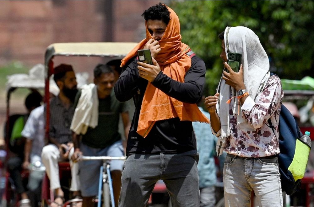
In simple terms, a Super El Niño amplifies normal El Niño effects, often weakening the Indian summer monsoon. This can lead to below-normal rainfall, prolonged dry spells, and increased heatwave intensity, especially across northern, central, and western India. Agricultural output becomes highly vulnerable, with rain-fed farming regions facing the highest risk.
Current weather conditions in India already indicate a pre-monsoon heat build-up, with several regions experiencing rising daytime temperatures. Northern states are seeing early heatwave-like conditions, while southern parts, including Andhra Pradesh, are witnessing humid afternoons with isolated thunderstorms. Meteorologists warn that such conditions may intensify if El Niño strengthens further in the Pacific.
Experts also highlight that Super El Niño years often bring weather instability, including erratic rainfall, sudden heavy downpours in some pockets, and drought-like conditions in others. Coastal regions may also experience shifts in cyclone formation patterns, although the exact impact varies from year to year depending on ocean-atmosphere interactions.
The India Meteorological Department (IMD) is closely monitoring oceanic indicators to assess monsoon projections. Early signals suggest a cautious outlook, with the possibility of an uneven or below-average monsoon if El Niño conditions persist into the peak season. Authorities are advising preparedness in agriculture, water management, and disaster response planning.


Comments
Sign in with Google to comment.